50m-cultural-vectors

Admin 0 – Countries

Posted in 50m-cultural-vectors on September 21st, 2009 by davidh – Comments Off on Admin 0 – Countries
countries_thumb
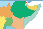
There are 258 countries in the world. Greenland as separate from Denmark. Most users will want this file instead of sovereign states, though some users will want map units instead when needing to distinguish overseas regions of France.

Natural Earth shows de facto boundaries by default according to who controls the territory, versus de jure.

read more »

Admin 0 – Details

Posted in 50m-cultural-vectors, Featured on Homepage on September 21st, 2009 by davidh – Comments Off on Admin 0 – Details
group_thumb
There are 209 sovereign states in the world, though only 199 issue passports. Auxiliary themes include 298 cartographic map units and 360 subunits optimized for labeling edge cases, like the four constitute countries of England, Scotland, Wales, and Northern Ireland in the United Kingdom.

read more »

Admin 0 – Boundary Lines

Posted in 50m-cultural-vectors on September 21st, 2009 by davidh – Comments Off on Admin 0 – Boundary Lines
home_image_3
Country boundaries on land and offshore

Natural Earth shows de facto boundaries by default according to who controls the territory, versus de jure. Adjusted to taste which boundaries are shown, hidden, and how they are rendered using the fclass_* properties to create POV worldviews.

read more »

Admin 0 – Breakaway, disputed areas

Posted in 50m-cultural-vectors on September 21st, 2009 by davidh – Comments Off on Admin 0 – Breakaway, disputed areas
disputed_thumb
Kashmir to the Elemi Triangle, ~100 features

Natural Earth shows de facto boundaries by default according to who controls the territory, versus de jure. Adjusted to taste which boundaries are shown, hidden, and how they are rendered using the fclass_* properties to create POV worldviews.

read more »

Admin 1 – States, provinces

Posted in 50m-cultural-vectors, Featured on Homepage on September 21st, 2009 by davidh – Comments Off on Admin 1 – States, provinces
states_thumb
Internal administrative divisions of countries

Natural Earth shows de facto boundaries by default according to who controls the territory, versus de jure. Adjusted to taste which boundaries are shown, hidden, and how they are rendered using the fclass_* properties to create POV worldviews.

read more »

Populated Places

Posted in 50m-cultural-vectors, Featured on Homepage on September 21st, 2009 by davidh – Comments Off on Populated Places
pop_thumb
City and town points, from Tokyo to Wasilla, Cairo to Kandahar read more »

Airports

Posted in 50m-cultural-vectors on September 21st, 2009 by Nathaniel – Comments Off on Airports
urban_area_thumb
Transportation 

read more »

Ports

Posted in 50m-cultural-vectors on September 21st, 2009 by Nathaniel – Comments Off on Ports
urban_area_thumb
Transportation

read more »

Urban Areas

Posted in 50m-cultural-vectors on September 21st, 2009 by davidh – Comments Off on Urban Areas
urban_area_thumb
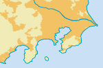
Area of dense human habitation.

read more »