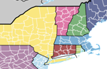
Admin 2 – Counties

About
Internal, second-order administrative boundaries and polygons for just the United States. Includes name attributes (including diacritical marks), name variants, and some statistical codes (FIPS, ISO, HASC).
Admin-0 units that lack admin-2:
All countries but the United States lack admin-2 features.
How-to
Use the following selection statement to derive this theme from the 10m lakes:
“ScaleRank” <=2 Then punch those selected features through the admin-1 and save result as a new feature class. Issues
This is the toughest dataset to keep current. A few changes happen in a decade in the United States, but other countries constantly rearrange their admin-2 units, slicing and combining them on a regular basis.
Boundaries should perfectly match the following NEV themes:
Coastline, lake shoreline, admin-0 country boundary, admin-1 state/province boundary, river and lake centerlines.
Version History


