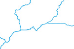
Rivers, Lake Centerlines

Generalized from the 10 million rivers. The 50 million rivers primarily derive from World Data Bank 2. Double line rivers in WDB2 were digitized to created single line drainages. All rivers received manual smoothing and position adjustments to fit shaded relief generated from SRTM Plus elevation data, which is more recent and (presumably) more accurate.
Lake centerlines obtained by manually drawing connecting segments in reservoirs. When available, Admin 0 and 1 political boundaries in reservoirs serve as the lake centerlines.
Ranked by relative importance. Includes name and line width attributes for creating tapered drainages.
(below) Congo River basin, Africa.

Includes scale ranks (large rivers, small rivers):
(below) Southern United States.

Avoid data dump overload:
(below) Quebec, Canada in Natural Earth compared to Digital Chart of the World.

Issues
Does not include intermittent rivers (eg: large seasonal rivers in Australia draining to Lake Eyre playas). Rivers in northeastern Russia and parts of the Amazon basin have suspect alignments.
Version History


